OUR PRODUCTS
Uberr Clone AppGojek Clone AppSuper App DevelopmentUberr Eats Clone AppGrocery App DevelopmentHandyman App Like Uberr
inDriver Clone AppDelivery App DevelopmentGlovo Clone AppBolt Clone AppLyft Clone AppCareem Clone App
OUR PRODUCTS

← Back to Blog
October 1, 2026
A practical guide to designing location tracking for ride-hailing, delivery, grocery, and home-service apps, from GPS capture to scalable backend processing.
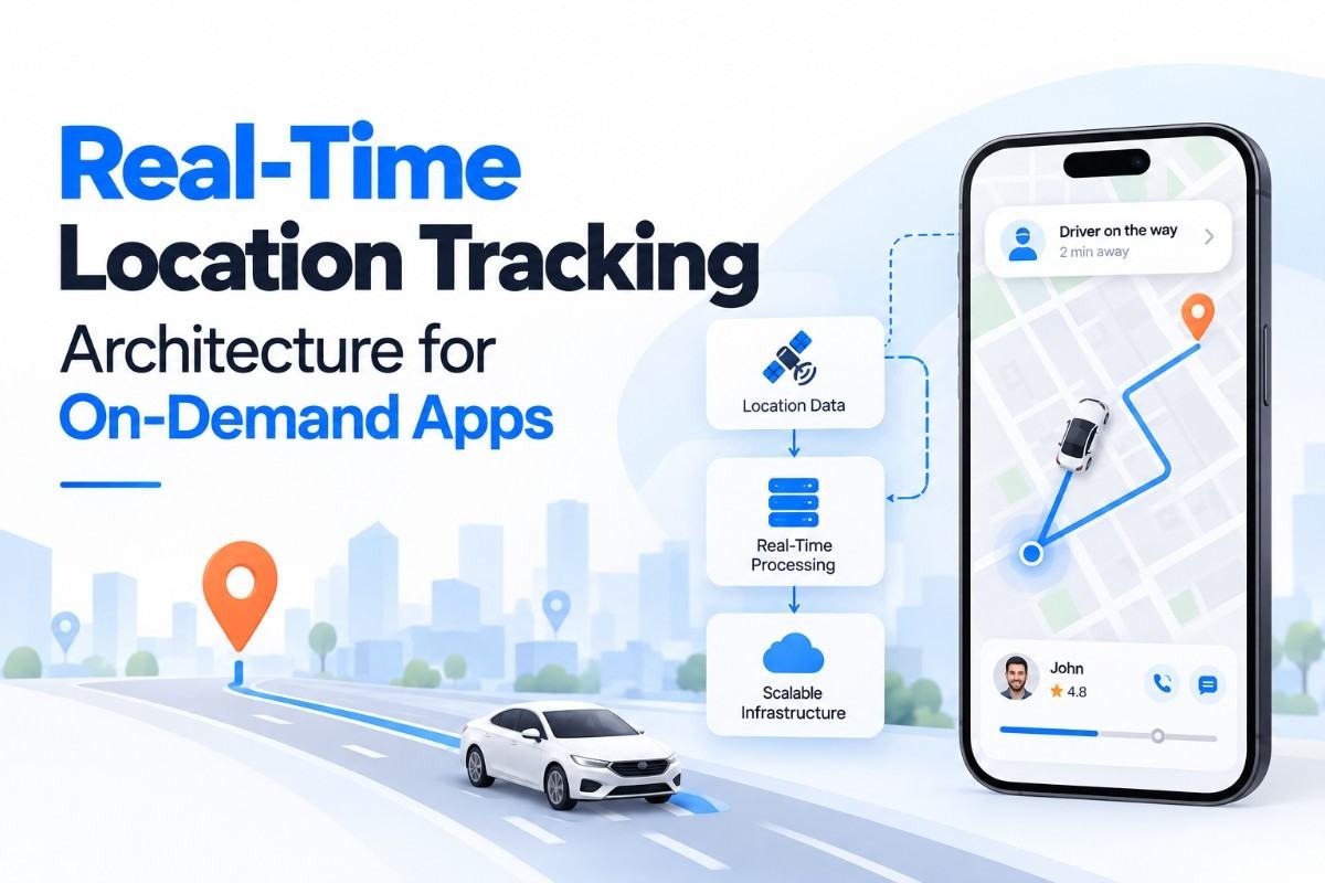
Location data is the operating signal behind most on-demand services. A passenger needs to see a driver's position, a customer wants an accurate delivery estimate, and an operations team must know when a provider has entered or left a service zone. The real time location tracking app architecture behind these experiences must process frequent GPS updates without draining batteries, exposing private data, or overwhelming the backend.
This is not simply a map integration. A production system connects mobile location services, an API layer, an event broker, geospatial storage, dispatch logic, notifications, monitoring, and access controls. It also needs different update rules for an active trip, an idle driver, a courier carrying an order, and a handyman travelling to a job.
This guide explains the architecture in practical terms. It covers the data flow, core components, scaling decisions, security controls, implementation sequence, and mistakes that commonly create inaccurate maps or high infrastructure costs. The same principles apply to ride-hailing, food delivery, grocery delivery, logistics, and home-service platforms.
Real-time location tracking architecture is the set of mobile, backend, database, messaging, and map services that collect, validate, distribute, store, and display moving asset positions. An asset may be a driver, courier, shopper, service professional, vehicle, or customer who has chosen to share their location.
The word “real-time” does not mean that every GPS reading is sent instantly to every user. GPS readings have accuracy limits, networks introduce delay, and sending data too frequently affects battery life. A useful design establishes an acceptable freshness target for each workflow. A live ride may need frequent updates during pickup, while a provider waiting for a new job may only need periodic presence updates.
For a taxi platform, this flow supports driver discovery, estimated arrival times, pickup verification, trip monitoring, and route history. For delivery businesses, it also supports order states, delivery zones, proof of arrival, and exception management.
Weak location infrastructure creates visible product problems. A customer may see a vehicle several blocks behind its actual position, a courier may receive an order outside the intended service area, or an administrator may be unable to explain why a delivery was marked late. These issues are usually caused by data freshness, poor event handling, inaccurate geospatial queries, or inadequate permissions rather than by the map itself.
Location also influences dispatch quality. Matching logic may consider distance, travel time, driver availability, service category, vehicle type, and operating zone. If the system uses stale coordinates, it may assign work to a provider who has already moved away. That creates avoidable cancellations and longer arrival times.
Infrastructure cost is another concern. A platform with thousands of active providers can generate a large number of location events. Sending every reading to the primary database and broadcasting every change to every connected user is expensive and unnecessary. A better design filters updates, separates hot data from history, and sends each audience only the information it needs.
Privacy and regulatory obligations make the design more important. Location is sensitive personal data in many jurisdictions. The platform should define consent, retention, access, deletion, and incident-response rules before launch. Apporio's cyber security services are relevant when these controls need to be reviewed as part of an on-demand product.
Fresh coordinates give dispatch services a better view of nearby supply. The system can search within a radius, rank candidates by distance or estimated travel time, and remove providers who have become unavailable. Accuracy improves further when the backend considers GPS confidence, heading, and the timestamp of the last update rather than trusting coordinates alone.
A moving marker, current status, and realistic arrival estimate reduce uncertainty. Customers can distinguish between “provider assigned,” “provider approaching,” “arrived,” and “service started.” The application should not display a false precision level; a coordinate with low accuracy should be represented cautiously instead of appearing exact on the map.
Administrators can identify stalled trips, providers who went offline, route deviations, and service-area violations. A current-location view is useful for immediate intervention, while historical records support dispute handling, performance analysis, and billing review.
Adaptive sampling prevents the system from treating every use case as an active trip. The application can increase frequency when a vehicle is moving toward a pickup and reduce it when the provider is stationary. Server-side filtering and audience-specific broadcasting further reduce unnecessary traffic.
The same location foundation can support taxi bookings, food orders, grocery shopping, package delivery, and home services. A modular approach allows each service to apply its own workflow rules while sharing identity, permissions, event processing, and monitoring.
For businesses planning multiple services, super app development can provide a broader product structure in which location capabilities are shared across separate service modules.
Start with the workflows, not the map SDK. Document when location collection begins, when it pauses, and when it ends. Typical states include offline, available, assigned, travelling to pickup, arrived, in service, completed, and suspended. Connect each state to business events such as booking accepted, order dispatched, provider arrived, or trip cancelled.
This prevents continuous tracking from becoming the default. It also gives product, engineering, privacy, and operations teams a shared definition of what the system should do.
Use the native location services on Android and iOS for permission handling, background behavior, battery controls, and sensor access. The client should attach a timestamp, accuracy value, heading, speed, device identifier, and session identifier to each update where permitted.
Do not request background location without a clear product reason. Explain the benefit to users, request the least privilege required, and provide a graceful experience when permission is denied. Mobile implementation may differ by operating system, so teams should test background restrictions, suspended applications, poor connectivity, and device-specific battery settings. Apporio's Android app development and iPhone app development services can support platform-specific implementation.
Location updates should enter through an authenticated endpoint or streaming gateway. Use short-lived access tokens, session checks, request validation, rate limits, and idempotency controls. The server should verify that the account is allowed to publish for the assigned job and that the event has not already been processed.
At this layer, discard malformed coordinates and flag readings with impossible movement. A basic plausibility check can compare the previous point, elapsed time, reported speed, and known transport mode. These checks will not prove that a reading is genuine, but they reduce obvious errors.
Current state requires fast reads and frequent overwrites. Route history requires durable storage, retention controls, and analytical access. Keeping both in one general-purpose table often causes write contention and makes cleanup difficult.
A practical model uses a fast key-value or in-memory store for the latest position, a relational database for bookings and state transitions, and a time-series or object-storage path for selected route history. The exact products depend on traffic, cloud environment, compliance needs, and the team's operating skills.
An event broker or streaming layer decouples location ingestion from downstream consumers. One consumer can update current position, another can evaluate geofences, and another can feed monitoring or analytics. This avoids putting dispatch, notification, and reporting logic directly inside the mobile request.
For customer-facing updates, WebSockets are suitable when the app needs an open bidirectional connection. Server-sent events can work for one-way server updates. Controlled polling remains a reasonable fallback for unreliable networks or low-frequency workflows.
Geospatial indexes allow the platform to search within a radius or identify assets inside a polygon. Use them for nearby-provider search, service zones, delivery areas, and geofence events. A straight-line distance is useful for initial filtering, but it is not the same as road travel time.
Routing services should be called selectively because route requests can become a major operating cost. Cache results where the route context remains valid, avoid recalculating for insignificant movement, and distinguish between a rough candidate search and a customer-facing arrival estimate.
The map client should not blindly render every received point. It can interpolate movement between trusted updates, smooth minor GPS noise, and show a “last updated” indicator. If the connection drops, the interface should communicate that the marker may be stale rather than presenting old data as current.
Test tunnels, dense urban areas, weak mobile networks, indoor pickup points, long trips, permission changes, app restarts, clock differences, and provider handoffs. Measure update delay, coordinate accuracy, reconnect behavior, battery impact, event loss, and recovery after service interruption.
Set update rules by workflow, movement, and accuracy. An active ride may use a shorter interval or movement threshold than an idle provider. A courier approaching a customer may need more frequent updates than a shopper waiting for inventory confirmation. Combining time and distance thresholds avoids sending repeated points when the device has barely moved.
Every event should have a unique identifier, server-received timestamp, device timestamp, and sequence value when possible. The consumer should tolerate duplicates and delayed messages. Monitoring should expose ingestion rate, processing delay, dropped events, reconnect counts, stale assets, and broadcast fan-out.
Encrypt data in transit and at rest. Apply role-based access so a customer sees only the location connected to their booking, while an operations user sees only the scope required for their work. Avoid placing precise coordinates in logs, analytics exports, or error messages unless there is a documented reason.
Define retention periods for live positions and route history. Provide consent records, account deletion handling, access reviews, and an incident process. Privacy controls should be part of the architecture rather than an interface checkbox added at the end.
The mobile client should queue a limited number of updates when connectivity drops, then discard points that are too old for live display. The backend should distinguish delayed history from current position. When the connection returns, the app should resynchronize state rather than replaying every old coordinate to the customer.
Use map tiles, geocoding, distance matrices, and route calculations according to their actual purpose. Debounce address searches, cache stable results, limit repeated route calls, and select the smallest useful map payload. Cost monitoring should be tied to bookings, active trips, and route requests so unusual increases are visible.
Separate location capture, authorization, ingestion, geospatial search, trip tracking, notifications, and history. This makes it easier to add a new business vertical without duplicating the entire tracking stack. It also allows engineering teams to replace one component without rewriting every mobile workflow.
For a taxi-first product, Apporio's Apporio Taxi Uber Clone Script and taxi dispatch software are relevant examples of products where tracking, dispatch, driver availability, and trip operations are closely connected.
These mistakes often appear during MVP work because teams focus on displaying a moving marker before defining data ownership, privacy rules, retention, and operational recovery. A smaller but explicit architecture is safer than an impressive map feature with undefined failure behavior.
No single delivery method is best for every on-demand application. The right choice depends on update frequency, connection stability, audience size, battery constraints, and how quickly the interface must react.
| Approach | Best fit | Strength | Limitation |
|---|---|---|---|
| Short-interval polling | Low-frequency status checks and fallback clients | Simple to implement and debug | Creates repeated requests and may show delayed movement |
| WebSockets | Active trips, live dispatch, and customer tracking | Low-latency bidirectional communication | Requires connection management, scaling, and reconnect handling |
| Server-sent events | One-way server updates to a web or mobile client | Useful for continuous server-to-client delivery | Less suitable when the client must send frequent events through the same channel |
| Event broker with consumers | Multi-service platforms and high-volume processing | Separates ingestion from dispatch, storage, and analytics | Adds operational complexity and requires observability |
| Hybrid architecture | Most mature on-demand platforms | Combines adaptive capture, streaming, fast current state, and durable history | Needs clear ownership and careful integration testing |
For many production platforms, the hybrid model is the practical direction. Mobile clients publish selectively, a streaming layer distributes events, a fast store serves current position, and durable storage retains only the history needed for operations, support, compliance, or analytics.
A reliable location platform is built around workflow requirements, not map visuals alone. The design must handle adaptive GPS capture, authenticated ingestion, event processing, geospatial search, current-state storage, route history, controlled broadcasting, privacy, and recovery from weak connectivity. Teams should define freshness targets and retention rules before selecting infrastructure.
For the real time location tracking app architecture behind taxi, delivery, grocery, or service operations, Apporio Infolabs can support the product layer through on-demand mobile app development, Uberr Clone solutions, Gojekk Clone solutions, and delivery app development. The correct scope depends on the service model, launch market, mobile platforms, dispatch rules, and expected operating volume.
It is the technical structure used to collect, validate, process, store, and distribute location updates from mobile devices. It typically includes mobile location services, authenticated APIs, event processing, geospatial storage, live connections, map services, and privacy controls.
The frequency should depend on the workflow, movement, network conditions, and battery requirements. Active rides or deliveries generally need fresher updates than idle providers. Adaptive time and distance thresholds are more practical than one fixed interval for every user.
They usually should be separated logically, and often physically. Current position needs fast reads and frequent overwrites, while route history needs durable storage, retention controls, and analytical access. Separating them reduces contention and simplifies data management.
WebSockets are useful for low-latency bidirectional communication during active trips. Server-sent events can support one-way server updates, while polling remains a practical fallback. Larger platforms often combine these methods with an event broker and separate current-state storage.
Use explicit consent, encrypted transport and storage, authenticated sessions, role-based access, limited data retention, careful logging, and deletion procedures. Customers should see only the location relevant to their booking, and administrators should receive only the access required for their role.
Yes. A shared foundation can handle capture, authentication, event processing, geospatial search, permissions, and monitoring. Each service should keep its own workflow rules for assignments, arrival states, delivery tracking, service zones, and history requirements.

